Unjokaku , the model plan of climbing relaxed the next day
Top> How to Enjoy Unjokaku List> Unjokaku , the model plan of climbing relaxed the next day
Fuji climbing is difficult because the body is not highly acclimatized.
I stayed at the 5th Station everyday, I got a good night's sleep, and I will definitely be able to climb better if I start the next day.
It is a recommended climbing technique for veteran climbers.
Stay at A course Unjokaku, climb slowly the next day 1 day 2 day course
First day
The first day of the bus of the Subaru line-Fujiyoshida root end points, 5th Station in the Unjokaku will stay on. You have to check in by dinner, so let's go out with a relaxing margin. The next morning's departure is early, so let's go to bed early and sleep soundly.
the 2nd day
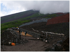
In early morning it will start in the darkest time in order to see the sunrise on the way.
At first, a gentle wide road continues, but after passing through the 6th Mt. Fuji Safety Instruction Center (2,390 m), you will enter the full-scale mountain path.
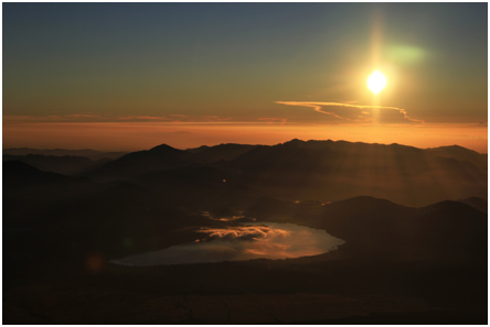
As you climb the zigzag climbing road along the falling stone prevention bank, the sky gradually starts to change and the orange light and the yellow light begin to mix in the blue gray sky. If you walk about 60 minutes from the sixth line, you will reach the seventh eye flower hut (2,700 m). I will look at Hikariko from here. The sun rises from among magnificent panoramas from everywhere.
Let 's get out of the headlamp if you are satisfied with the light. It is climb of about 300 m from the seventh to the eighth consultation.
A little sudden climb will continue. Let's climb while taking a break in the middle because there is time to spare.
Choose a steady rock without rushing, and if you step up step by step, you will reach the Taishokan, the eighth station (about 3,040 m) in about 90 minutes.
If it is sunny, you may also see Lake Yamanakako, the Pacific Ocean, the Izu Peninsula, and the Sky Tree in Tokyo if you're lucky.
Yatsugatake will also be floating above the clouds.
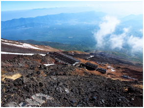
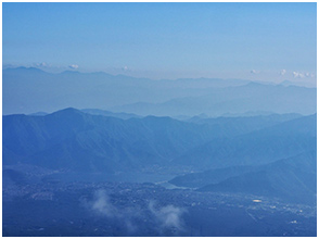
Many huts come out from here. It may be a good memorial to have a bamboo stick pressed. I think that the eighth line is 3,380 m, from this side the line of the top will be visible. Let's climb without saying that you are beginning to see the summit. It is mountain climbing that we do not arrive easily since the top is visible.
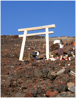
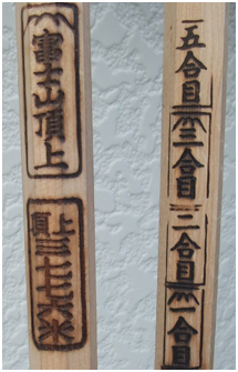
The ninth eyed with a torii and small shrine past several huts is 3,570 m. If you climb repeatedly zigzag slowly at the same pace from here, you will go through the torii of Kuzushi shrine in about 2.5 hours. I arrived at the summit of the Yoshida route (3,710 m). Because the summit is cold, let's stop slowly and come with wind stoppers and down.
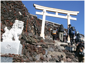
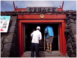
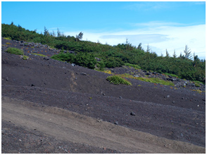
When taking a commemorative photo at the summit, we will visit Kuroshi Shrine and go back to the summit. To get back to the departing Subaru Line 5th Station we will get off the Shimoyama Road of the Suzumi / Yoshida route. Shimoyama road is a wide sandy road. It is a gentle way down to the zigzag. Let's rush from saying that it's going down, and let's not rush and drop stones.
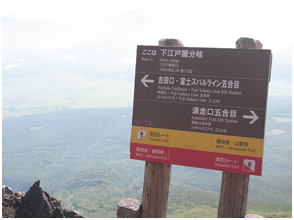
In about an hour you will arrive at the 8th branch (3,270 m) at Sukuguchi and Yoshidaguchi. Let's check the route by looking at the Edo shop (Shimo Edo shop) and the guide board as a landmark. Every year, there are climbers who are straying at Yoshidaguchi and Sukiguchi, so be careful. It will arrive at the seventh line (2,640 m Fuji public toilet) in about an hour and a half. If you rest your legs firmly go to the sixth eyes.
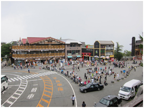
After passing through the falling stone prevention shelter, passing through the forest of Dakkanba, the sixth eyes are soon. After passing the branch with Sato hut, if you follow the same road as climbing it is the 5th Station .
5th Station Unjokaku in, good even cultivate the excellent talent in lingonberry ice, I think that is also good with something Gui beer to thirsty throat.
- Course time is very different from person to person. It is a reference time to the last.
About information in this homepage
- About the behavior time (walking time) etc. in this homepage, we assume general climbers (beginners), but it also changes greatly depending on their own physical strength / experience and weather conditions. Please consider it as a guide only. In addition, the rest time is not included in the course time.
- Please bring topographic map etc of 1/25 thousand of the Geographical Survey Institute at the time of actual climbing. In addition, depending on the time the mountain hut is not yet opened, it may be closed. Please climb the local information after confirming it.
- Climbing routes and bus routes to hiking trails are sometimes closed due to natural disasters. Please be sure to check the information in advance.
- We are not responsible for this website for accidents, accidents etc occurred during climbing. Please enjoy climbing at your own risk.


